

New Mexico hiking doesn't get much more dramatic than dropping into the Rio Grande Gorge at Wild Rivers Recreation Area near Questa, New Mexico. If you've never stood on the rim of that ancient volcanic canyon and looked straight down at the silver ribbon of river six hundred feet below, well, friend, you've got something to look forward to.
For Paulette and me, the Big Arsenic Trail became something much more than a hike. It became a lifeline — a warm-weather refuge from the bone-deep cold of our mountaintop life at Casa Oso.
Casa Oso, Cold Winters, and the Need to Escape
We built Casa Oso — Bear House — atop our mountain at 9,500 feet near Angel Fire, New Mexico, back in 2000, and we loved every wild, snowy, magnificent minute of our seventeen years there. The name wasn't whimsical. When we first built, bears were practically neighbors. Summer mornings often meant a half-dozen of them wandering the property. They'd lumber up onto the deck like they'd been invited for lunch, and more than once we had to shoo one off just to enjoy a sandwich in the afternoon sun. Out our bedroom picture window, we'd hang a hummingbird feeder on the log railing, and I can still picture a big black bear balanced on his hind legs on that railing, tongue working toward that little glass bottle of sugar water. Bears have remarkable balance — I'll give them that. As the years passed and more neighbors built along our mountain loop, the visits tapered to a bear or two a week, then less. Progress, I suppose, though we mourned the change a little.
But winters at 9,500 feet are serious business. By January, snowpack around Casa Oso regularly hit two to three feet. The skiing up at Angel Fire was usually excellent, and we took full advantage in the early years. Snowshoeing was another option, but at our age, post-holing through deep powder gets old fast. It's beautiful, sure. It's also exhausting in a way that stops being fun after the first mile.
What we missed most, though, was hiking. Just walking — on a trail, in the sun, with the smell of earth and juniper around us. So we started driving.
Wild Rivers Recreation Area sits about an hour and fifteen minutes northwest of Angel Fire, give or take road conditions, out past Taos and up through Questa. In winter, when Casa Oso was buried in snow and the high mountain temperatures were in the teens, the canyon country near Questa could be fifteen to twenty degrees warmer. That doesn't sound like much until you're standing in fifty-degree sunshine in January, and it feels like a gift.
Getting There: Questa, Red River, and the High Road
The drive alone is worth the trip. From Angel Fire, we'd head west through the Moreno Valley — and almost without fail, crossing over Bobcat Pass and dropping into the valley, we'd spot elk. Big herds of them, sometimes fifty or a hundred animals grazing the tall grass in the morning light, breath steaming, antlers catching the winter sun. Now and then a flock of wild turkey would pick their way along the fence line. It was the kind of scene that makes you feel lucky to live where you live.
Passing through Red River, a charming mountain village tucked into its namesake canyon, and then rolling into Questa, the landscape shifts. The mountains give way to high mesa country, and the Rio Grande Gorge begins to reveal itself in hints — a sudden drop off the edge of the world that sneaks up on you if you don't know it's coming.
Questa itself is a small, unpretentious northern New Mexico community with deep Hispanic and mining roots. From there, you head west on NM-378, and within about three miles, you're pulling into Wild Rivers Recreation Area.
Wild Rivers Recreation Area: The Basics
Wild Rivers sits at the confluence of the Rio Grande and Red River gorges, a place managed by the Bureau of Land Management that somehow stays off the radar of a lot of New Mexico hikers. That's a shame, because it's spectacular.
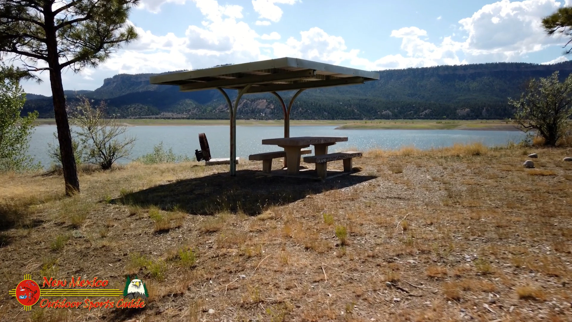
Trail access and facilities: The recreation area has a well-maintained visitor contact station where you can pick up maps and get current trail conditions. Clean restroom facilities are available at the trailhead parking area. There's a small campground with sites along the rim that offers some of the most dramatic camping views in the state. The day-use fee is modest — typically charged per vehicle, consistent with standard BLM recreation area rates — and an America the Beautiful pass covers it if you have one.
Seasons and weather: The canyon country here is accessible most of the year, though summer afternoons can push into the 90s on the canyon floor. Spring and fall are ideal. Winter, as we discovered, can be surprisingly mild compared to the high mountains nearby, but always check road and weather conditions before heading out — NM-378 can be tricky after a storm. Morning temperatures in winter will still require layers.
The Big Arsenic Trail: Heading Down
The Big Arsenic Trail is approximately 1.5 miles one way from the rim to the Rio Grande, dropping roughly 650 feet into the gorge. That descent happens over rocky, well-maintained trail with some sections that get genuinely steep. The footing is generally good, but hiking poles are your friends here — especially on the return trip, which we'll get to in a moment.
What to bring: Sturdy hiking boots with ankle support are non-negotiable on this trail. The volcanic rock is uneven and can be loose in places. Trekking poles, as mentioned, make the steep sections significantly more manageable. Water — carry more than you think you need, especially in warmer months. The canyon is exposed and the climb out will work up a serious sweat. Sunscreen and a hat are essential. Paulette always packed a lunch, and that was one of the finer traditions of our Big Arsenic days.
The trail descends through high desert scrub — chamisa, Apache plume, scattered juniper and piñon — with the canyon walls growing more dramatic with every hundred feet of elevation you lose. The basalt formations along the gorge walls are volcanic in origin, part of the vast lava fields that blanket this corner of New Mexico. The colors shift through the day as the light changes — deep black, red-brown, ochre, and in early morning, a kind of bruised purple that's hard to describe and impossible to forget.
Big Arsenic Spring: A Desert Miracle
About 1.4 miles from the trailhead, just before you reach the river, you arrive at Big Arsenic Spring, and it stops you in your tracks every time. Here, water seeps cold and clear from the volcanic rock, feeding a lush riparian oasis that feels entirely out of place in the dry canyon. Cottonwoods, willows, and dense green growth cluster around the spring in a way that makes your eyes almost disbelieve what they're seeing after the rocky desert descent.
The spring gives the trail its memorable — if eyebrow-raising — name. The arsenic in question refers to naturally occurring trace minerals in the spring water, a geological quirk of the area. You'll want to treat or filter any spring water before drinking, but the sight and sound of it are free and priceless.
This is where Paulette would spread out lunch. We'd sit on the rocks, eat our sandwiches, listen to the river tumbling past just below us, and feel the particular satisfaction that only comes from earning a beautiful place with your own two feet. The Rio Grande here runs cold and fast, a serious river in a serious canyon. Fly fishermen work these waters for brown and rainbow trout, and it's some of the finest wild trout water in New Mexico — deep pools behind boulders, fast riffles, long glassy runs. If you're a trout angler, bring a rod. A New Mexico fishing license is required, and the Rio Grande Gorge section is managed as quality water worth respecting.
I remember one afternoon at the spring, scanning the basalt cliffs above the river with binoculars, when I spotted an otter working the far bank. Smooth and quick, slipping in and out of the current like the river was made for him and the rest of us were just visiting. I've seen a lot of wildlife over the years, but that otter felt like a secret the canyon was sharing.
The Petroglyphs: Messages From Deep Time
A short distance upstream from the spring, the river trail leads to a petroglyph rock that I consider one of the quiet treasures of northern New Mexico hiking. The images are pecked into the dark desert varnish of a large basalt boulder — spirals, figures, animals, symbols whose meanings have been carried away by centuries and silence.
Petroglyphs are found throughout the Southwest, but there's something about encountering them in this remote canyon setting that hits differently than seeing them in a roadside pullout. These required effort to reach. The people who made them came down into this gorge with purpose, and whatever that purpose was — ceremony, record-keeping, communication, art — it mattered enough to carve into stone.
I'd stand at that rock with groups of kids I'd sometimes guide down from the village or from neighbors' families up on our mountain loop, and you could watch the moment it landed for them. The moment they understood they were looking at a human hand reaching across a thousand or more years. Questions would start flying — who made them, why, what do they mean — and I never had complete answers, which was probably the best thing. Some mysteries are worth preserving.
The Ancestral Pueblo peoples and their predecessors inhabited this region for thousands of years before Spanish colonization. The Rio Grande Gorge was not empty wilderness to them. It was home, highway, and sacred landscape. The petroglyphs at Big Arsenic are a reminder to walk humbly.
Paying the Price: The Climb Out
Here's the honest truth about the Big Arsenic Trail that every trail description should lead with: enjoy the descent, because you're going to earn every foot of it on the way back out.
The climb is about 650 feet over roughly 1.5 miles, but those numbers don't fully communicate the experience. The first half mile or so isn't terrible — the grade is moderate, the footing reasonable, the views already starting to open up beautifully as you gain elevation. Then you hit the steep section.
Our strategy was simple and I recommend it highly: a hundred yards at a steady pace, then stop and enjoy the view. Another hundred. Stop. Breathe. Look at the canyon walls, the river growing smaller below you, the vast sky. Then another hundred. And on and on. It's not a race. It's a gorge.
When you finally pull yourself up over the rim and feel flat ground under your feet again, there's a particular quality of satisfaction that I've experienced in very few other places. A kind of full-body exhale. Reaching the car was always cause for a moment of ceremony — nothing formal, just Paulette and me looking at each other and grinning like we'd gotten away with something.
The Drive Home
The ride back through Red River and across Bobcat Pass into Moreno Valley was the icing on the cake, as I've always said. Tired legs, full stomachs, the afternoon light going golden over the mountains. More elk in the valley, almost always. Sometimes a hawk riding a thermal above the pass. The particular peace that comes from a day well spent in wild country.
Why Big Arsenic Still Lives in My Heart
I still have to fight back tears recalling those trips, even after all these years. There's something about a place that saves you from winter — not just the cold, but the long sameness of it, the cabin fever, the aging body's impatience — that earns a permanent room in your memory.
The Big Arsenic Trail is not a casual stroll. It's a real hike that asks something of you. But what it gives back — the spring, the river, the petroglyphs, the wildlife, the ancient geology, the silence of a deep canyon on a winter morning — is extraordinary by any measure.
If New Mexico hiking is on your list, and it should be, put Wild Rivers Recreation Area near the top. Drive out through Taos and Questa, park at the rim, and head down toward the river. Pack a lunch. Bring poles. Take your time at the petroglyph rock.
And enjoy the descent — because you'll pay the price on the way back out.
Wild Rivers Recreation Area is located approximately 3 miles west of Questa, New Mexico on NM-378. For current trail conditions, fees, and camping information, visit the BLM Taos Field Office website or contact them directly before your visit.
https://nmosg.com/wp-content/uploads/2026/03/map-wild-rivers-trails-tfo-2022.pdf


0 Comments