
There's something magical about an alpine lake that speaks to my soul. Maybe it's the crystal-clear waters reflecting snow-capped peaks, or perhaps it's the peaceful solitude that envelops you when you're sitting on the shore with nothing but the whisper of pines and the occasional splash of a trout breaking the surface. After eight decades on this earth—with my boyhood spent in the Flint Hills of Kansas and my golden years blessed with the majesty of New Mexico's mountains—I've developed a particular fondness for alpine lakes that don't require a young man's legs to reach.
From behind the wheel of my trusty Jeep Wrangler that Paulette lovingly calls "The Mountain Goat," I've explored every accessible high-country lake across northern New Mexico. Today, I want to share some of these treasures with you—gems that don't demand strenuous hikes or backpacking expeditions, but instead welcome visitors who arrive on four wheels, whether by car, 4x4, or UTV.
Eagle Nest Lake: The Crown Jewel of the Moreno Valley
Lake Size: 2,400 acres
Elevation: 8,195 feet
GPS Coordinates: 36.5463° N, 105.2631° W
Mountain Range: Sangre de Cristo Mountains
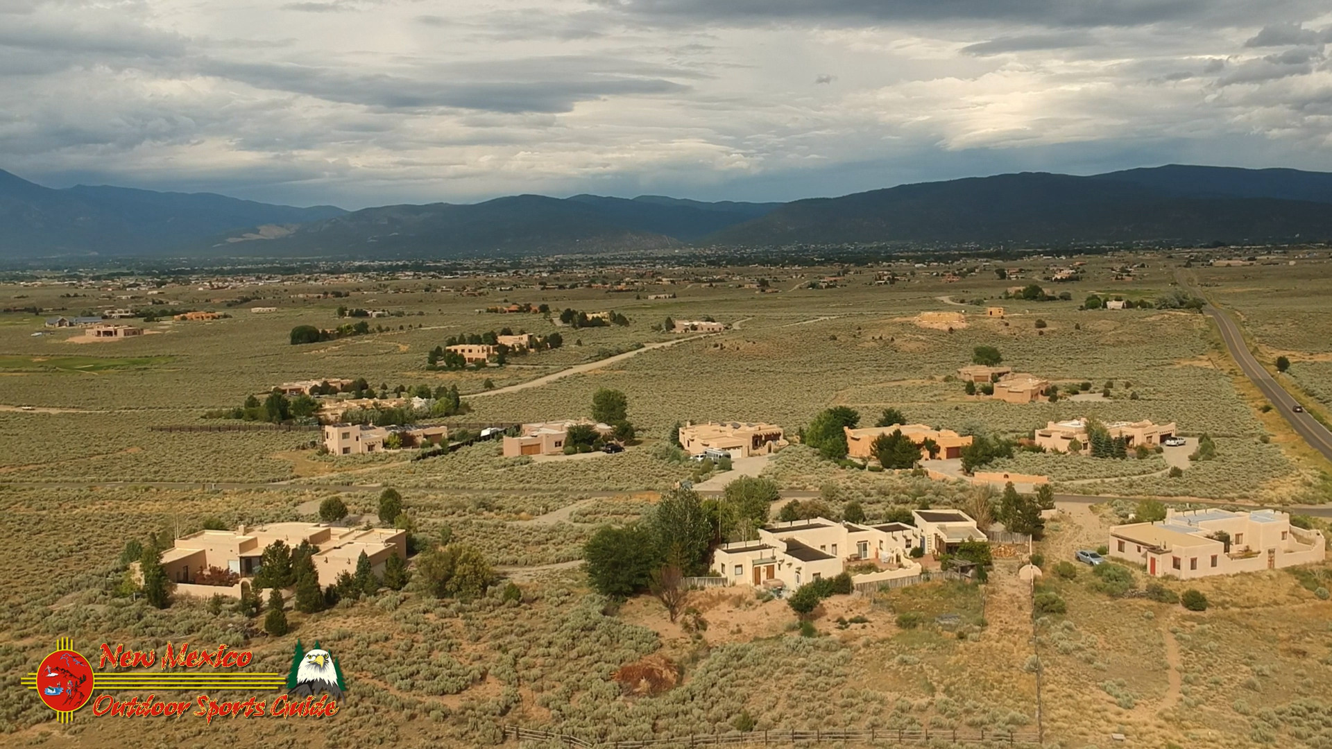
Every morning for nearly twenty years, I opened my curtains to a panoramic view of Eagle Nest Lake shimmering in the valley below our Angel Fire mountain home. This magnificent body of water isn't just accessible by car—it's visible from Highway 64 as it winds through the breathtaking Cimarron Canyon.
Fishing Information
Eagle Nest is a cold-water fisherman's paradise that holds a special place in my heart. The lake is stocked with rainbow trout, but it's the kokanee salmon and northern pike that keep anglers coming back. I've spent countless hours trolling these waters with Paulette, our small aluminum boat cutting through the morning mist as the sun hits Wheeler Peak to the west.
The lake freezes solid in winter, typically from December through March, creating one of the state's most popular ice fishing destinations. Back when my knees were more cooperative (just a decade ago), I'd join the hardy souls drilling through 12 inches of ice to drop lines for perch and trout.
Camping Information
Eagle Nest Lake State Park offers well-maintained campsites with electric hookups at the south end of the lake. For those who prefer more creature comforts (and at my age, I certainly do), the village of Eagle Nest has several charming motels and cabins. The winds can be fierce across this wide-open valley, so secure your tent well if you're tenting it.
Driving Directions
From Santa Fe, take US-84/US-285 north to Española, then NM-68 to Taos. From Taos, follow US-64 east through the Rio Grande Gorge and into the mountains. The drive takes about 2 hours and 15 minutes but plan for longer—the scenery demands frequent stops for photographs, particularly at the Rio Grande Gorge Bridge.
Parking Information
The state park has ample paved parking, including accessible spaces near the boat ramp. During peak summer weekends, arrive before 9 AM to secure a spot close to the water. I've learned this lesson the hard way more times than I care to admit.
Hiking Trails
The lake offers a short, paved trail suitable for all mobility levels that follows a portion of the shoreline. For those craving more adventure, the nearby Clear Creek Trail provides stunning views of the lake from above.
Wildlife
The Moreno Valley is a paradise for wildlife photographers. Bald eagles winter here (hence the lake's name), and osprey dive for fish during summer months. At dawn and dusk, mule deer emerge from the forest edge to drink. I've filled countless memory cards capturing elk herds crossing the shallow marshes at the north end of the lake.
Best Time of Year
Each season paints Eagle Nest in different colors. Spring brings wildflowers and hungry fish rising to the surface. Summer offers perfect temperatures and afternoon thunderstorms that create dramatic light for photography. Fall transforms the surrounding aspens into a golden spectacle that doubles in beauty when reflected in the lake. Winter's frozen expanse feels like standing in a snow globe. If pressed to choose, I'd say September offers the perfect balance—fewer tourists, stable weather, and wildlife preparing for winter.
Heron Lake: A Sailor's Delight
Lake Size: 5,900 acres at full capacity
Elevation: 7,186 feet
GPS Coordinates: 36.6989° N, 106.7050° W
Mountain Range: Tusas Mountains
When Paulette and I moved to Santa Fe in 2017, one of our first adventures was trailering our small sailboat to Heron Lake. Despite my 77 years at the time, the sailor in me couldn't resist the call of New Mexico's largest sailing lake.
Fishing Information
Heron Lake operates under special catch-and-release regulations that have produced some of the largest lake trout in the state. Unlike many New Mexico lakes, Heron maintains a consistent water level, making it more reliable for fishing year-round. My friend Carlos, who's been fishing these waters since the 1970s, taught me to target the deep channels near the dam for record-sized trout. This lake holds the state record for lake trout—a monstrous 31-pounder caught in 1992.
Camping Information
Heron Lake State Park offers both developed campgrounds and primitive camping areas. Blanco and Willow Creek campgrounds have electric hookups suitable for RVs, while the primitive areas provide more privacy. After a day on the water, there's nothing quite like settling into a camp chair with Paulette, watching the stars reflect in the lake's still surface while reminiscing about our Kansas days.
Driving Directions
From Santa Fe, take US-84/US-285 north, then continue on US-84 past Abiquiu toward Tierra Amarilla. Follow signs for Heron Lake State Park near Los Ojos. The drive takes approximately 2 hours from Santa Fe and is entirely on paved roads suitable for any vehicle.
Parking Information
The main marina area has extensive paved parking for vehicles with boat trailers. The lot rarely fills completely except during major holidays and fishing tournaments. During our frequent visits, we've never had trouble finding a spot, even with our truck and trailer.
Hiking Trails
The 5.5-mile Rio Chama Trail connects Heron Lake to nearby El Vado Lake, offering spectacular views of both bodies of water. For easier walking, the quarter-mile Island View Trail provides scenic vistas with minimal elevation change—perfect for these old knees of mine.
Wildlife
Heron Lake's extensive shoreline attracts a remarkable diversity of wildlife. Ospreys nest in tall ponderosas along the water's edge, and the lake's name is no coincidence—great blue herons stalk the shallows during summer months. On early morning visits, we've spotted black bears coming down to drink, quickly retreating when they sensed our presence.
Best Time of Year
May through October offers the most reliable weather for boating and fishing. I especially love late June when the surrounding forest is lush and green, and afternoon thunderstorms create dramatic skies perfect for photography. The lake rarely freezes completely in winter due to its depth, creating unique opportunities for winter fishing if you can brave the cold.
Bluewater Lake: Desert Meets Alpine
Lake Size: 1,200 acres
Elevation: 7,400 feet
GPS Coordinates: 35.3003° N, 108.1087° W
Mountain Range: Zuni Mountains
Visiting Bluewater Lake feels like discovering a secret oasis. Though not as high as some alpine lakes, its position in the Zuni Mountains creates a fascinating transition zone between desert and alpine environments.
Fishing Information
Bluewater Lake's claim to fame is its tiger muskie population—a hybrid predator fish that can reach impressive sizes. The state record was caught here, measuring over 50 inches. When Paulette and I visited in 2019, I was fortunate enough to hook (and release) a 38-inch tiger muskie that gave this old man the fight of his life. The lake also contains rainbow trout and catfish for those seeking less toothy adversaries.
Camping Information
Bluewater Lake State Park offers three campground areas with sites accommodating everything from tents to large RVs. The east side campground provides the most shelter from winds, which I highly recommend based on personal experience with a nearly-airborne tent in 2018. Vault toilets and water spigots are available throughout the park, with hot showers centrally located.
Driving Directions
From Albuquerque, take I-40 west to Grants, then follow NM-412 north about 25 miles to the lake. The route is entirely paved and suitable for any vehicle, making it one of the more accessible alpine lakes in the state.
Parking Information
Large, gravel parking areas exist at each boat ramp and campground. Even during summer weekends, parking remains ample. For day visitors, I recommend the lot near the dam, which offers excellent views and easy shore access.
Hiking Trails
The 3-mile Dam Trail circles the northern portion of the lake, offering spectacular views with moderate elevation changes. For those with mobility concerns, the quarter-mile Shoreline Trail near the main boat ramp provides accessible lake access and excellent fishing spots.
Wildlife
The transition zone between high desert and mountain environment creates unique wildlife viewing opportunities. Pronghorn antelope sometimes visit the lake's eastern shores, while ospreys and bald eagles patrol from above. During one memorable visit, Paulette and I watched a family of river otters playing near the dam—a rare sight that had us reaching for our cameras.
Best Time of Year
Spring and fall offer the most comfortable temperatures and productive fishing. Summer brings afternoon thunderstorms and larger weekend crowds, while winter sees few visitors despite remaining accessible year-round. My favorite time to visit is early October when the surrounding piñon-juniper woodland contrasts beautifully with the deep blue water.
Abiquiu Lake: Georgia O'Keeffe's Inspiration
Lake Size: 5,200 acres
Elevation: 6,283 feet
GPS Coordinates: 36.2367° N, 106.4181° W
Mountain Range: Jemez Mountains foothills
Though not as high as other lakes on this list, Abiquiu Lake's remarkable setting among red rock formations made famous by Georgia O'Keeffe's paintings earns it a place in any discussion of New Mexico's must-visit lakes.
Fishing Information
The lake supports healthy populations of smallmouth bass, walleye, and catfish that thrive in its warmer waters. Shore fishing is productive near the dam and along the many coves and inlets. My neighbor in Santa Fe, Richard, introduced me to bass fishing here in 2018, and at 78 years old, I discovered a new passion for the sport.
Camping Information
Riana Campground offers developed sites with picnic tables, grills, and vault toilets. The U.S. Army Corps of Engineers maintains the facilities admirably. For a truly unique experience, consider the primitive camping at Ghost Ranch, just a few miles away, where you can sleep amid landscapes straight from O'Keeffe's canvases.
Driving Directions
From Santa Fe, take US-84/US-285 north toward Española, then continue on US-84 west toward Abiquiu. The drive takes approximately 1 hour on well-maintained highways suitable for any vehicle.
Parking Information
The Corps of Engineers provides numerous parking areas around the lake, with the largest lots near the visitor center and boat ramp. Even during summer holidays, we've always found adequate parking.
Hiking Trails
The Abiquiu Dam Overlook Trail offers spectacular views with minimal exertion—perfect for visitors with limited mobility or energy. For a more substantial adventure, the Corps of Engineers maintains several shoreline trails varying from 1-3 miles in length.
Wildlife
The juxtaposition of desert and water creates a haven for diverse wildlife. Mule deer are common near the shoreline at dawn and dusk. Golden eagles nest in the nearby cliffs, and during migration seasons, the lake attracts countless waterfowl. I've spent many peaceful hours with my camera capturing great blue herons fishing along the shoreline as the red cliffs glow in evening light.
Best Time of Year
Unlike higher-elevation lakes, Abiquiu remains accessible and comfortable nearly year-round. Spring brings wildflowers and active fish populations, while fall offers spectacular color as cottonwoods along the Chama River turn golden. Summer temperatures can climb into the 90s, so early morning or evening visits are preferable during June through August.
Fenton Lake: A Small Wonder
Lake Size: 35 acres
Elevation: 7,900 feet
GPS Coordinates: 35.8806° N, 106.7306° W
Mountain Range: Jemez Mountains
Don't let its modest size fool you—Fenton Lake packs immense charm into its small footprint. Nestled among towering ponderosa pines in the Jemez Mountains, this intimate lake feels more like a private retreat than a state park.
Fishing Information
Fenton Lake is regularly stocked with rainbow trout and also contains brown trout and Rio Grande cutthroat. The small size and easy access make it perfect for anglers with limited mobility. I often bring a lawn chair and fish from shore, watching osprey dive for their own catch nearby. The lake's reputation for quality fishing is well-deserved—I've never been skunked at Fenton.
Camping Information
Fenton Lake State Park offers developed campsites suitable for tents and small to medium RVs. The sites are tucked among tall pines, providing welcome shade and privacy. Paulette and I have made this a regular overnight destination during our summer explorations from Santa Fe, appreciating the cooler temperatures at this elevation.
Driving Directions
From Albuquerque, take NM-550 to San Ysidro, then NM-4 through Jemez Springs and past Jemez Falls. The access road is paved and suitable for all vehicles, though it narrows and winds considerably through the mountains.
Parking Information
A paved lot near the boat ramp provides ample parking for day visitors. Additional parking areas are scattered throughout the park, rarely filling except on holiday weekends. Handicapped spaces are available near the fishing dock, which I've come to appreciate more in recent years.
Hiking Trails
The Lake View Trail makes a 1-mile loop around the lake, offering beautiful views with minimal elevation change. For more adventurous hikers, the park connects to the vast network of Jemez Mountains trails, including routes to nearby Seven Springs Fish Hatchery.
Wildlife
The dense forest surrounding Fenton Lake harbors a remarkable diversity of wildlife. Elk frequent the meadows near the park entrance at dawn and dusk. Wild turkeys strut through the campground, and black bears occasionally make appearances (keep your food secure!). During our last visit, we witnessed a family of otters playing near the fishing dock—a magical moment I'll cherish forever.
Best Time of Year
Late May through October offers the most reliable access and comfortable conditions. Paulette and I particularly love mid-September when the aspens begin changing color and summer crowds have diminished. Winter brings heavy snowfall, often closing access roads, though determined visitors on snowmobiles can still reach the frozen lake.
Charette Lakes: History and Solitude
Lake Size: Two lakes: Upper (12 acres) and Lower (10 acres)
Elevation: 8,500 feet
GPS Coordinates: 36.0369° N, 104.9203° W
Mountain Range: Sangre de Cristo foothills
Perhaps my most treasured "hidden gem" in northern New Mexico, the Charette Lakes sit in splendid isolation atop a mesa southwest of Cimarron. The journey here requires more determination than the other lakes on this list, but the reward is profound solitude.
Fishing Information
These small lakes punch above their weight for fishing quality. Both contain rainbow and brown trout, with the occasional cutthroat making appearances. The New Mexico Game and Fish Department stocks them regularly during accessible months. My most memorable catch here wasn't particularly large—just a modest 16-inch rainbow—but the experience of landing it as the sun set behind Baldy Mountain, with no other anglers for miles around, elevated it to something special.
Camping Information
Primitive camping is permitted around both lakes, with no designated sites or facilities beyond a single vault toilet. Pack in, pack out principles apply strictly here. Despite the rustic conditions, Paulette and I have spent several anniversaries camping at Upper Charette, our small teardrop trailer providing just enough comfort for these old bones while preserving the wilderness experience.
Driving Directions
From Cimarron, take NM-21 south for approximately 12 miles, then turn west onto Forest Road 1950. The final 5 miles requires high clearance, and 4WD is recommended in wet conditions. The drive from Cimarron takes about 45 minutes, depending on road conditions.
Parking Information
Informal parking areas exist near both lakes, consisting of cleared areas without pavement or designated spaces. Even during peak summer weekends, you're unlikely to encounter more than a handful of other vehicles.
Hiking Trails
No maintained trails exist around the lakes, but game paths circumnavigate both shorelines. The open terrain makes cross-country hiking relatively straightforward. For more adventurous explorers, unmaintained forest service trails lead deeper into the surrounding wilderness.
Wildlife
The relative isolation of these lakes creates exceptional wildlife viewing opportunities. Elk and mule deer are abundant, especially near dawn and dusk. Beavers maintain lodges in both lakes, and their evening activities provide delightful entertainment from camp. During a memorable visit in 2022, we watched a black bear sow with cubs foraging along the opposite shore—maintaining a respectful distance while capturing incredible photographs.
Best Time of Year
Access is typically limited to late May through October due to snow. July and August bring spectacular wildflower displays to the surrounding meadows, while September offers cool nights and intensely blue skies. My personal favorite time is late June when the first monsoon storms create dramatic lighting while keeping the dust down on access roads.
El Vado Lake: Historic Waters
Lake Size: 3,200 acres
Elevation: 6,900 feet
GPS Coordinates: 36.5950° N, 106.7297° W
Mountain Range: Tusas Mountains
Just south of its larger sibling, Heron Lake, El Vado offers a different character—a bit wilder, less developed, and steeped in the history of the Rio Chama region.
Fishing Information
El Vado maintains healthy populations of kokanee salmon, rainbow trout, smallmouth bass, and northern pike. Unlike some nearby lakes, water levels can fluctuate significantly here, which affects fishing conditions throughout the season. My fishing buddy Carlos taught me to target the underwater structure near the old river channel for the best results with bass, while the main body of the lake produces excellent trout action during spring and fall.
Camping Information
El Vado Lake State Park offers both developed and primitive camping areas. The main campground provides electrical hookups and modern facilities, while the more remote areas offer greater privacy and unfiltered night skies. Paulette and I prefer the primitive sites along the northeastern shore, where the views of the Chama Valley at sunset are simply breathtaking.
Driving Directions
From Santa Fe, take US-84/US-285 north, then continue on US-84 past Abiquiu toward Tierra Amarilla. Follow signs for El Vado Lake State Park. The journey takes approximately 2 hours from Santa Fe on paved roads suitable for any vehicle.
Parking Information
Gravel parking areas exist at the main boat ramp, campgrounds, and day-use areas. During summer weekends, the boat ramp lot can fill early, so arrive before 9 AM if you're launching.
Hiking Trails
The 5.5-mile Rio Chama Trail connecting El Vado to Heron Lake offers spectacular views and moderate hiking. For those seeking easier terrain, the Overlook Trail provides expansive vistas with minimal elevation change—perfect for photographers like myself who lug heavy camera equipment.
Wildlife
The steep canyon walls and sheltered coves create diverse wildlife habitats. Osprey and bald eagles patrol the skies, while mule deer and elk frequent the shoreline at dawn and dusk. During one magical evening in 2021, Paulette and I watched a family of river otters fishing and playing near our campsite, completely unfazed by our presence.
Best Time of Year
May through October offers the most reliable weather and road conditions. September provides my favorite combination of smaller crowds, stable weather, and active fish. Winter access can be challenging after heavy snowfall, but the lake rarely freezes completely, offering unique fishing opportunities for those willing to brave the cold.
Conclusion: Finding Heaven in High Places
After eight decades on this earth—from those wide-open Kansas Flint Hills of my youth to these magnificent New Mexico mountains of my golden years—I've developed a profound appreciation for these accessible alpine waters. They offer not just recreation but restoration for the soul.
Paulette often jokes that my obsession with these lakes borders on the religious, and perhaps she's right. There's something deeply spiritual about sitting beside an alpine lake as the sun rises, watching the mist dance across the water's surface, hearing nothing but the whisper of wind through pines and the occasional splash of a rising trout.
Whether you're an angler, photographer, wildlife enthusiast, or simply seeking the peace that only high places can provide, New Mexico's accessible alpine lakes have something profound to offer. The fact that we can reach these elevations with our vehicles rather than our hiking boots is a blessing for those of us with more miles on our odometers than we care to count.
As I write this from our Santa Fe home, looking forward to our summer explorations and planning our winter escape to Lake Mohave, I feel immense gratitude for these alpine treasures. May you find as much joy in their discovery as Paulette and I have over these many years.
Pat is an octogenarian photographer, writer, and explorer who divides his time between Santa Fe, New Mexico and Lake Mohave, Arizona. After retiring from his Kansas ranching roots, Pat and his wife Paulette built their dream mountain home in Angel Fire before relocating to Santa Fe in 2017. His photography and writing celebrate the natural wonders of the American Southwest, with a special focus on accessible adventures for seniors.


0 Comments